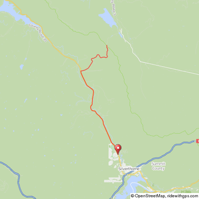
Ute Pass
This 31-mile round trip with about 2,000' of climb starts at Silverthorne Elementary School, heads north on highway 9 on a slightly downhill route for 10 miles paralleling the Lower Blue River to Ute Pass Rd (Colorado route 15). Take a right on Ute Pass Road and make the nice 5.3-mile climb up to the summit at the Summit/Grand county line.
An alternative for a much shorter ride that still contains the 5.3 mile summit climb is to drive to the right-hand turn at Ute Pass Road and park there in the small dirt lot on your right.
The first 1.2 miles of the climb on Ute Pass road averages about 4%, the next 3.4 miles about 5.6% and the last 0.7 mile is essentially flat.
The views of the Gore Range on the descent are wonderful.
Highway 9 can have a lot of traffic, but the shoulder is nice and wide from Silverthorne out to Ute Pass road and at times feels almost like a bike path.
As with many of the routes here, this one can be coupled to others to create a longer ride or different starting point.
Ute Pass
Click map for an interactive version and
downloadable GPS files.
Elevation Profile

