Mt. Blue Sky "Hill" Climb
NOTE: the Mount Blue Sky Scenic Byway (CO 5) is closed for the entire 2025 season. The closure began in September 2024 and will last until Memorial Day weekend 2026 due to roadway construction. This means motorized and non-motorized travel (including biking and hiking) is prohibited on the road leading to the summit.
This is a ride (climb) to the summit of one of Colorado's "14ers" - peaks over 14,000' in elevation and to the top of the highest paved road in the country.
The start point in Idaho Springs is about 45 minutes east of Summit County, but if you fancy yourself a climber, this and Pikes Peak are the "Big Kahunas” for cycling in Colorado. It's a 56-mile round trip consisting of 28 miles up; all up - 7,000' of climb from an elevation of 7,500' all the way up to 14,200' and then 28 miles back down the same road. For sure, climbing between 12,000' and 14,000' is a lot different than climbing from 10,000' to 12,000’.
One of 11 Switchbacks

Local Mt Blue Sky Residents

Mt. Blue Sky from Idaho Springs
Road above Summit Lake

You will pass through 3 climate zones, passing ancient trees, lakes and forest, and land above timberline; and may see a mountain goat or two as well. Keep in mind that the summit is at 14,240 feet, so you can expect chilly temperatures and the chance of rapid weather changes.
The climb has a short flat at Echo Lake and a slight downhill just before Summit Lake. Grades to Echo Lake average 3.5% for 6.7 miles and 5.8% for 5.8 miles. Echo Lake to the summit averages 5.6% for 5.5 miles, then 4.1% for 2.7 miles and finally 5.7% for 4.25 miles to the top.
Note that there may be a park entrance fee charged beyond Echo Lake.
Drive east on I-70 to Idaho Springs exit 240, turn right and park at the Forest Service Visitor Center on the south side of I-70. Ride up Colorado 103 to just past Echo Lake and then turn right onto Route 5 to the summit.
Once there, enjoy the expansive views, but also look down and marvel at the view of the 11 switchbacks you just rode. You've now bagged one of Colorado's "14ers" in a unique fashion. If you want to get a sense of the magnitude, check out The Col Collective’s video.
This ride is done as a timed race in July each summer. A number of pro cyclists participate in addition to age group classifications for us mere mortals. The course record is held by Tom Danielson, who did the climb in 1:41:20 in 2004 and again in 1:42:09 in 2009 - that's averaging 16 mph on the way UP! Click here for more info.
Heading to the Sky

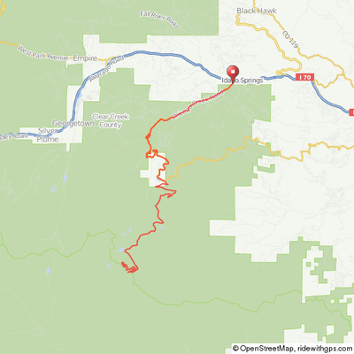
Click map for an interactive version and
downloadable GPS files.
Elevation Profile

28 miles to top, 7,000' of climb
